

Procedures
LiDAR Planning
Planning begins with Optech's ALTM-NAV software suite. It incorporates the latest toolsets and algorithms to collect data as efficiently as possible. The software allows operators to change mission plan parameters while in the air, and the ability to generate a "quick view" of the data immediately following a collection. Optech's ALTM-NAV Flight Management Software provides complete pre-mission and in-air flight planning capability, sensor system control and monitoring, and navigation, all in a single easy-to-use package. With integrated lidar and camera planning capability for simultaneous multi-sensor data collection, underlying DEM planning capability, and realtime swath coverage directly exportable to Google Earth.
Also, ALTM-NAV is able to use ancillary DEM information from a variety of sources. Since mission success is often gauged by the ability to collect complete data in the most efficient manner possible, an underlying DEM will enable planners to be aware of topographical changes that may affect swath widths and resultant planned flight line overlaps.

Similarly, real-time projection of the lidar data onto the underlying DEM will enable system operators to verify coverage in the air more effectively before leaving the survey site to return to base
Ground Control Network

Before starting aerial acquisition begins, a fundamental procedure for the accurate Lidar and Imagery Acquisition is the location of the ground control points (GCP). Once the areas are selected, LiDAR America will deploy the Ground survey team to start fixing the first static GCP, have the GNSS Station L1/L2 running for at least 6 hours.
The position will be processed in Spectra Precision software, triangulating satellites, ephemerides and COR Stations nearby to obtain the final Coordinates, we will repeat the same procedure every 15 km to create a geodesic network, after the GCP are established, we will create a network of check sites using RTK mode over fixed monuments or fixed objects for the aerial triangulation correction.
During the flights the GNSS stations collect data one hour before and one hour after all acquisition flights. Considering the location of the area of interest (AOI), is necessary to locate the nearest reference station of the Active Geodetic Network, with the intention of linking the LiDAR data and the photographs to a known frame of reference.
A first order geodesic network is built utilizing monument or marker plate on natural terrain, positioning the GNSS base station for a minimum observation time of 5 hours, this time is subject to the distance between the chosen reference station and the GNSS base station.
LiDAR Checkpoints
In conjunction with the local licensed land surveyor, Lidar America typically distributes checkpoints uniformly throughout the project area (not clustered) to assess the accuracy of LiDAR. Checkpoints are set up in open bare earth areas, free of obstructions. It is important to note, checkpoints are for mere assessment of LiDAR and will not be used directly on the Lidar data for dZ adjustments
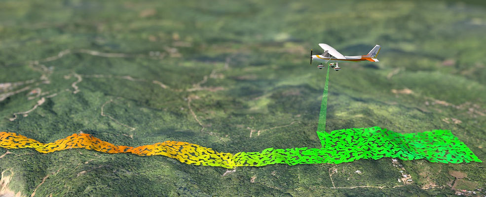
LiDAR and Photography Acquisition
Prior to LIDAR collection a calibration flight will be performed if necessary. Generally, these calibration flights are carried out in two opposite directions on the same calibration area. Additionally, parallel flights are made to the opposite directions with an overlap specified by the needs of the client. The results obtained in one direction are compared with the opposite direction. The attitude misalignment parameters derived from the calibration flights and the modeled "windup" values will be used in post-processing to resolve systematic errors in the data.
Ground crew will establish a high precision GPS base station at the airport with another at the area of interest. RAW GPS data is taken from the base stations daily and is reviewed throughout the acquisition process. If any anomalies are detected, they are addresses immediately to ensure that the raw data is corrected before it moves into processing.
Each flight mission is logged in detail, recording local weather conditions, lines flown and their direction, sensors and equipment used, and all settings. Flight data is reviewed daily to verify the area of interest is sufficiently covered edge to edge with no gaps in flight lines, or voids in the data/imagery.

Acquisition flights only occur when conditions permit. Data/imagery is only captured when the ground is not obscured by snow, haze, fog, or dust. Streams and waterways will be within their normal banks, and cloud cover will not cast shadows or obscure the imagery. Data will not be collected when crosswinds are 20 knots or greater, or crab angle is greater than 5 degrees. Data is not collected in strong turbulence to provide a stable platform for cameras and sensors. If any unacceptable data or imagery is collected, the impacted areas are re-flown at no additional cost to the customer. During flight operators verify a satellite network of at least six satellites are present during collection for optimal GNSS performance.
To ensure that the entire area of interest is covered, Lidar America typically includes a buffer zone of at least 200m around the specified area of collection. The flight crew acquire data and imagery through the entire buffer zone, and held to the same standards and specifications as the defined area of interest. Before any acquisition missions are flown.
LiDAR Processing
Processing of aerial LIDAR data is extremely intensive, complex and time consuming, especially for accurate and reliable results. Range data, GPS, IMU and satellite data are processed together to create LAS and SBET files for further processing. Processing generally begins with POSPac Mobile Mapping Suite, an Applanix next generation industry leading GNSS-Aided Inertial post-processing software for georeferencing data collected from cameras, LIDARs, multi-beam sonars and other sensors on mobile platforms.
Static and dynamic GPS information are post-processed after each flight to obtain the accuracy of the position of the aircraft for each instant of measurement. The PosPAC MMS software is used to generate a trajectory file that includes the corrected information of the aircraft for all sets of positioning data obtained during the entire flight.
The next step is the generation of LAS files by flight line. Teledyne Optech LMS is a processing workflow tool designed specifically for high-volume production processing. From automated lidar calibration to extensive geodetic conversions, accuracy reporting, and parallel processing.


Utilizing LMS, the next step is the generation of LAS files. Trajectory files, as well as data range (swaths) are the initial instruments. For every LiDAR flight executed it will be necessary to look for any type of anomalies in the data, such as data gaps. When the data has been corrected for any anomalies, the LMS data can be exported as LAS.
Once the points are imported into Microstation/Terrasold, point clouds are tiles and classified using an algorithm to first classify ground points then classify remaining points according to their height and shape into further classes (building and vegetation). Subsequently, an exhaustive quality control must be done manually, with the intention of identifying structures that are misclassified. The number of classes and their type will depend on the objectives and scope of a given project.


After classifying the information of each tiled file in different classes, it is necessary to ensure matching as accurately as possible between the different flight files. This process is done with the help of Terrramatch: The X, Y, Z, heading, pitch, roll and drift are all adjusted for the best possible fit within areas of overlapping flight lines. At this time, it is possible to generate the intensity images, which are sent to the photogrammetric processing department for the geo-rectification of all the images captured with the camera.
Another manual quality check is performed, specifically for misclassified ground (eg. buildings, bridges). This is performed by creating DEM models to visually see any anomalies in the data. The misclassified data is then correctly classified. The geoid is then adjusted to OCFA specifications and quality checked.
Aerial data is then Hydro-Enforced using common processing techniques by use of polygons of water bodies such as streams or lakes.

Photogrammetric Processing
Range data, GPS, IMU, and satellite data, as in LiDAR data processing, are processed together to create trajectory files, which contain global positioning data (x, y, z) in addition to natural movements of the aircraft (Yaw, Pitch, Roll), with the trajectory file we proceed to georeference each photo taken during the flight, either RGB or multispectral.

With georeferenced photos, aerial triangulation is performed in Photoscan, this software is a 3D modeling solution based on images from still photos and looks for common points in the photos and combines them, as well as the position of the camera for each image, refining the camera calibration parameters and as a result, a cloud of scattered points and camera positions are formed.
The main objective of aerial triangulation is to produce from ground control, sufficient points on the photogrammetric models to ensure that each model can be precisely oriented as needed for orthophoto stereo compilation or line mapping in digital or analog form.

The next stage is the generation of a surface: mesh and / or DEM. The 3D polygon mesh model represents the surface of the object based on the dense or sparse point cloud. After rebuilding the surface, the orthomosaic can be textured and generated. These DEM and point cloud results are necessary to form the orthophoto, however, they will not be the final deliverables, since for that we will use the LiDAR data


In addition, it is necessary to perform a rectification to improve the accuracy of the orthophoto, extracting the intensity images from the LiDAR point cloud, and then using it as a reference to create ground control points (GCP) manually on the orthomosaic. It is compared with similar points between the intensity image and the mosaic in Erdas Autosink Workstation to perform ortho-rectification.
Finally, in Global Mapper it is necessary to balance the brightness, contrast and color adjustment to unify the coloring of the orthomosaics and after that we can export mosaics divided into 1km x 1km quadrants (Or whatever size is required) of the products. RGB or Multispectral in JPEG 2000, TIFF, etc.


With the rectified images we can start to generate the planimetry in the 2D plane to extract traces of buildings, properties, roads, etc. Likewise, you can begin to extract each of the deliverables as required.
See Products for more information.
Reports
At the end of the study, a report is delivered which details the study area, the methodology used, coverage in km2, captures of the different systems, studies carried out, processing and final deliverables; as well as analysis and results.

Workflow
